Category: Chile

  • Torres del Paine – III – Completing the Loop

    Torres del Paine – III – Completing the Loop

    Intro | Part I | Part II | Part III

    Day 7 – Campamento Italiano

    Map (link) | Distance: 7.5 km + 5 km | Time: 1.75 hours + 3 hours

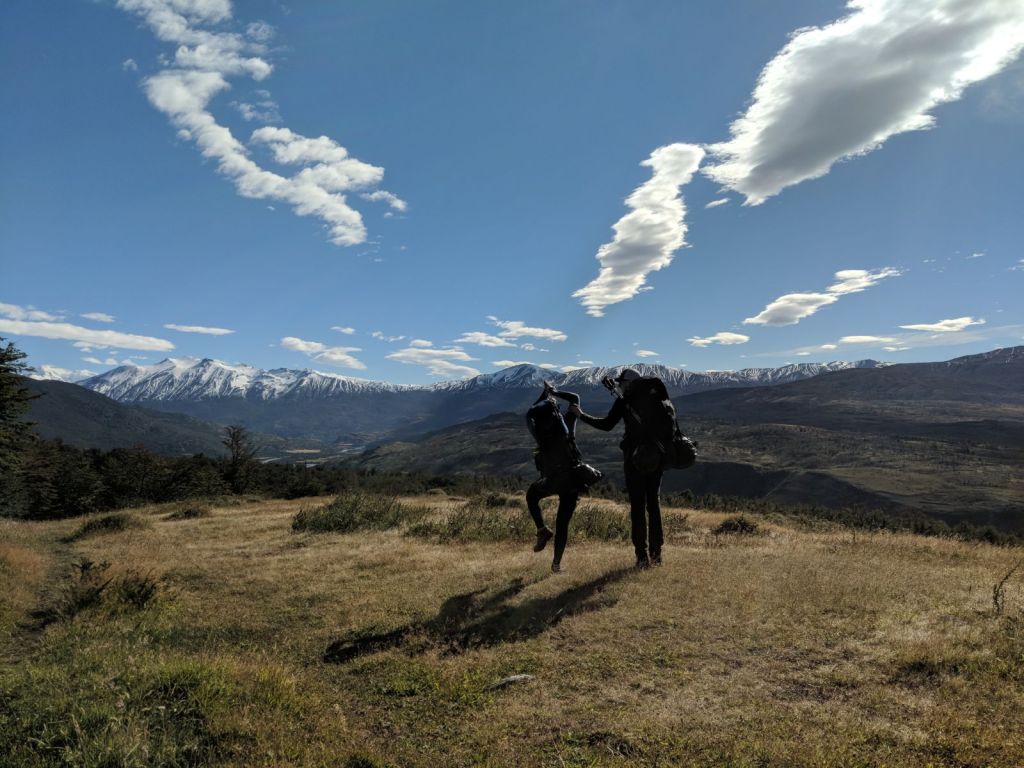
    The hike from Paine Grande to Italiano is one of the shortest hikes in the park, designed so hikers can enjoy a “day hike” past Italiano to a pair of mountainside lookouts (Francés and Británico) which make up the middle leg of the “W”. Knowing this, we set out before sunrise hoping to maximize our daylight hours for the day hike.

    IMG-20180402-WA0091
    Awake really early on Day 7

    The hike to Italiano was fairly straight forward: we left the windy peninsula of Paine Grande and headed East across hillsides and streams, stopping periodically to admire a lakeside view. We arrived at camp fairly early (before many campers had even woken up), set up our tents, and checked in with the Ranger. The Ranger gave us some tips and directions, but informed us that the second lookout, Británico, was closed due to poor weather.

    The day hike is bit awkward: it travels along the mountain side so the footing is tricky, full of rocks and inclines. We reached Francés Glacier after an hour and rested a minute to appreciate our fourth glacier of the week. Then we actually continued on, hoping to see more (the weather in Patagonia changes so frequently that we hoped the trail would clear up, contrary to the Ranger’s recommendation). Unfortunately the wind and rain only worsened so we turned back before getting lost (or worse) and had warmed our hands drinking tea and cooking dinner to rest up before a long hike to Chileno the next day.


    Day 8 – Chileno

    Map (link) | Distance: 16 km | Time: 5.5 hours

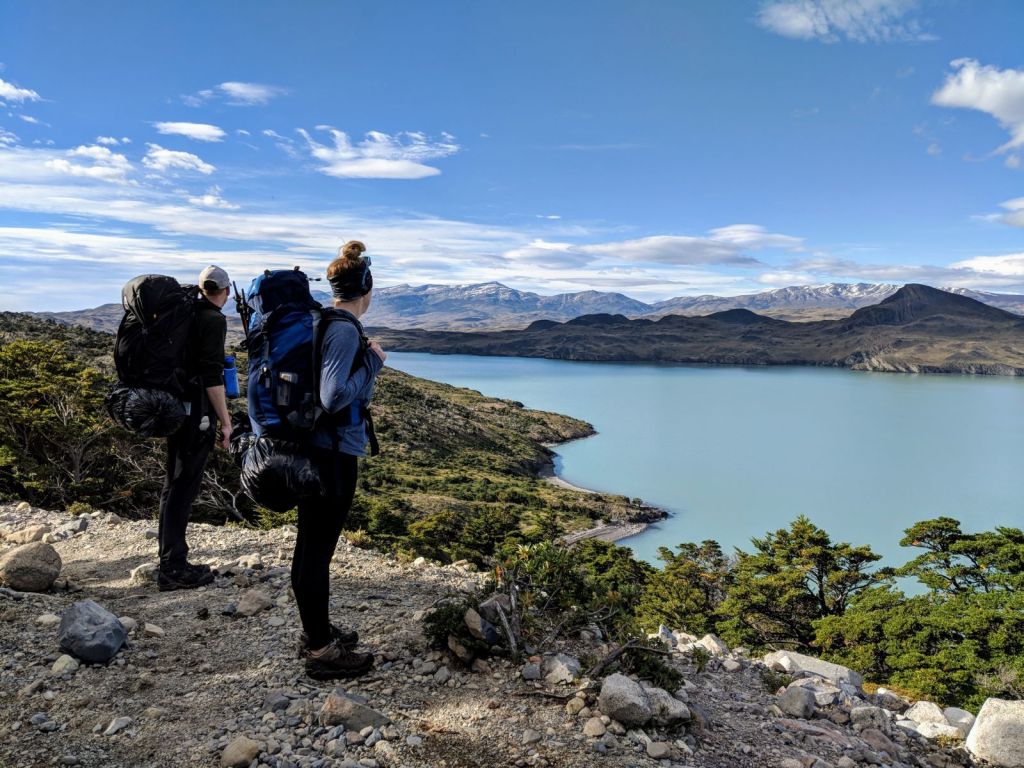
    The hike to Chileno was an exhausting day. We got on the trail a bit later than usual (I slept in) and paid for it with a long hike through the middle of a hot afternoon. We started off in hilly lakeside grassland and forest, which were actually delightful in the morning hours (some of the lake views were incredible, and we passed the oft-photographed Cuernos).

    DSC02173
    Cuernos (Horns) del Paine

    However, we left the forest just as the sun was reaching its peak and began a 4-hour hike uphill through open grassland. Many stops for water and sunscreen later, we started to see the mountain range surrounding los Torres which helped to put a spring in our step and push us up the final hill to Refugio Chileno.

    After checking in we set up our tents, which involved a new twist for our last night. Because the campsite is built on the side of a mountain, every tent gets erected on a wooden platform using a hammer and nails instead of stakes!

    The campsite and lodge are beautifully nestled between a stream and mountain, under the gaze of los Torres. Dinner that night was included in our reservation, so we enjoyed some salmon, rice, and salad (real food!) before watching the sunset (what a view) and heading to sleep.


    Day 9 – Our Final Hike

    Map: (link) | Distance: 4 km + 2 km | Time: 2 hours  + 1.5 hours

    Over the course of eight days on the trail we grew into a pretty standard sleeping pattern: sunlight = awake. So we had fine tuned our ability to fall asleep and wake up early, but our last night really pushed us. Researching for the trip we learned that a must-do activity in the park is watching the sunrise at the Torres del Paine. Which means starting your final (2-hour) hike to the Torres well before any daylight arrives. For us, that meant setting an alarm for 4:45 am, sleeping in our hiking clothes, and eating a Cliff bar on the trail (no time for breakfast).

    The hike was a little tricky: everything was pitch black outside of our headlamps’ paths and we were navigating climbing switchbacks through a forest. Fortunately the trail markers contained reflectors, so we only got lost a couple times, and we made the summit fairly quickly. We were actually the very first group to reach the top! So we settled into our sleeping bags and broke out our celebratory chocolate.


    Truthfully we were hoping for a more dazzling display of light, but even in overcast weather it was a treat to watch the Torres greet the day. And what better place to sit and reflect than a peaceful glacial lake surround by mountain tops? Looking back, it was a quick week in which we’d graduated from being hiking rookies, bested the elements, and lived more than a handful of post-card-worthy moments.


    The rest of the day was a mostly wrap-up. After lunch at Chileno we headed downhill to the trailhead, celebrated with a beer, and boarded the bus back to Peurto Natales where hot showers and fresh food awaited. From there we enjoyed a couple great celebratory meals (Angelica’s is highly recommended) and began our journey back home.

    IMG-20180402-WA0085
    Success! (Not pictured: cervezas)
  • Torres del Paine – II – John Gardner and Glacier Grey

    Torres del Paine – II – John Gardner and Glacier Grey

    Intro | Part I | Part II | Part III

    Day 4 – Campamento El Paso (John Gardner Pass ⛰️)

    Map (link) | Distance: 8 km | Time: 7.5 hours

    We had been gently warned by the rangers that most hikers should leave camp around 7:30 am to climb the John Gardner Pass, so despite the rain and chill we were up and on the move early on Day Four. Luckily the rain had calmed down over night so packing our tents up wasn’t too messy and we set out on our relatively short but very steep hike (the Pass is the highest part of the trail, at just under 1,200 m).

    IMG-20180402-WA0089
    Early morning selfie


    The trail started out with the forest and dirt we’d grown accustomed to, but turned to rocky switchbacks before long. The rocks made our footing a touch unsteady, and more than once my wobbly ankles almost rolled. Fortunately the weather had blown out after its overnight outburst, so we had relatively clear skies to make our upward grind tolerable and we reached the pass in just a couple of hours!

    One of the great things about Torres del Paine is that it has so many beautiful features. Magazines often feature the Cuernos del Paine. Everybody makes time to visit the namesake Torres. And there are countless viewpoints and tours of Glacier Grey’s Southern tip. But for me, reaching the Gardner Pass takes the cake. There was something incredibly rewarding about climbing the 1,200 m and feeling exhausted but proud. Then just as you’re beginning to feel big, a king literally on top of the world, Glacier Grey slaps you in the face. You look out on a sheet of ice stretching further than you can even comprehend. It contains more white, greys, and blues than your eyes can register in its cracked surface and exposed depths. It stretches as far as you can see, ending only in purer and larger snow capped mountains. It was a truly humbling reminder that the Earth is just so much bigger than us. It’s just so much…ice.

    The rest of the hike is relatively less grand. You turn back South and start working your way downhill. The hills are steep but there are often handrails and steps, (though that didn’t stop my Bambi-like grace from taking the express route once or twice) and a few lookouts through the trees reminding you of the inescapable ice sheet.

    We arrived at Campamento El Paso in mid-afternoon a little tired from the day’s climb and pitched our tents before sitting about in the sun to warm up (the glacier is cold and we were tired). Dinner that night was a smaller affair as our “O-circuit” group had started to break apart as schedules diverged, but we still got to hear plenty of stories about Antarctic adventures and backpacking South America before we packed it in for the night.

    Day 5 – Refugio Grey

    Map (link) | Distance: 7 km | Time: 4.5 hours

    Looking back, our near-perfect experience climbing the John Gardner Pass was pretty special. Because of its proximity to the Glacier Grey, and Patagonia’s generally hectic weather, the pass is frequently closed by Rangers, especially late in the season (when we visited). To that point: the two days after to our climb the trail was closed, and another two days later it was shut for the season. We just squeaked through!

    Knowing this as we were reserving campsites we had actually bracketed in an extra day following the pass, and we awoke on Day 5 grateful for that. The weather had settled into a chilly rain (something to do with a giant glacier nearby?) and our legs were feeling some aches after the climb, so it was nice to start the day slowly. We hit the trail around 10 am after filling up on oatmeal and boiling enough water to brew our tea (Early Grey, hot).

    IMG-20180402-WA0086
    Grumpy in the rain

    The trail to Refugio Grey was almost entirely downhill through the same cliff side forest we had encountered the previous day. The views looking out at the glacier were similarly impressive, if somewhat diminished by overcast skies. And thankfully we had the views to enjoy, because what was billed as an easy stroll down to Grey became bit of a mental battle. A little bit because of the weather, but mostly because of our knees not enjoying the downhill slog. Almost five hours later we reached Grey tired, grumpy, wet (and probably smelly, it’d been five looong days).

    But boy were we excited to arrive! Refugio Grey marks the Western start of the more built up “W Circuit” so in addition to camping spots and a cooking room, Grey had a full lodge complete with restaurant, bar, hotel, and spa. Hallelujah! We dropped our messy backpacks at the door and stumbled inside ordering “tres cervezas” and cheers’d to rejoining society! We spent the rest of the evening chatting with fellow hikers beside the fire place, enjoying a couple drinks, and honestly just appreciating the comfortable couch.

    Day 6 – Refugio Paine Grande

    Map (link) | Distance:  11 km | Time: 4 hours

    After an evening spent relaxing, Day 6 became the easier day we needed. It was another late morning as none of us set an alarm, andeven when we finally sorted ourselves out we didn’t hit the trail right away. Refugio Grey is considered the starting of the “W Circuit” because of its proximity to and scenic viewpoints of Glacier Grey. So before leaving we wandered out to take our last looks.

    Afterwards we hit the trail, heading south to Paine Grande, and though the skies were grey the worst of the clouds blew over and our hike was dry. Much of the trail looked like our first couple of days: long grass and stubby trees. Knowing the day’s hike was relatively short we took our time, stopping for photographs and snacks throughout the afternoon.

    Arriving at Paine Grande we were quick to understand how it earned the nickname “tent graveyard”. The lodge and campground are situated on a peninsula between two lakes, and wind gusts consistently threatened to uproot everything not bolted down. This was definitely our most nerve wracking tent set-up. Luckily our tents held on and, even though it was a noisy night, we woke early the next day with all our belongings!


  • Torres del Paine – I – The Backside

    Torres del Paine – I – The Backside

    Intro | Part I | Part II | Part III

    Day 1 – Campamento Serón

    Map: (link) | Distance: 13 km | Time: 4.5 hours

    Saturday morning was an early one. We had a 7 am bus ride to the park ahead of us, which meant getting up at dark o’clock and double checking our backpacks before heading out. Fortunately our hostel, the Erratic Rock, provides a warm breakfast every morning so we made our way to the bus full of homemade bread, oatmeal, and omelettes, if a little sleepy.

    The pre-dawn bus ride to the park let us see some brilliant scenes as sunrise played out on distant mountains, and by the time we were dropped off at the trailhead we were pretty excited. A final taste of normal (a muffin) in the gift shop and we were off!

    DSC01895
    Starting out, our first ‘climb’

    The first day of hiking was a nice ease into the routine. Our bags doesn’t hurt (yet), the hills were gradual, and the weather was fantastic. The shuttle-bus contingent quickly split up as every group found their pace, and soon enough the three of us were casually strolling through nature and sunny skies. The path to Campamento Serón is mostly hilly grassland on the Eastern periphery of the mountains, following a winding river North for much of the afternoon. It was funny at times to think we had just traveled two days  when the hike felt so similar to Ontario’s Bruce Trail. But every far-off mountain peak was a quick reminder otherwise, and we spent much of the afternoon taking breaks and doing our best Owen Wilson impressions (wow!).

    Our first night in camp was pleasant, if a little windy. As it was the first time setting up our new tents, we were happy to find spacious, level spots sheltered from the worst of the elements. We ate our first camp meals and chatted a little with our new “O Circuit” family of campers before settling in for the night with plans for an early rise.

    Day 2 – Refugio Dickson

    Map (link) | Distance: 18 km | Time: 7 hours

    Our first morning on the trail was a learning experience. Despite well meaning plans to rise early and head out after a quick bite, we didn’t actually start hiking until almost 10 am. Repacking your bag (from inside the tent) and disassembling a tent took longer than anticipated. We got much better on subsequent days.

    IMG-20180402-WA0087
    Day two selfie

    The trek to Dickson was quite similar to the previous day’s. We spent the morning following the same winding river and the weather remained promising with blue skies and puffy clouds stretching to the horizon. The biggest difference in the trail began as we turned West into the valley. The map noted that the trail would feature “Heavy Winds” at this point, and we were curious to find out what that meant. For me, it finally illustrated the expression “screaming winds” as a constant gale force wind rang in your ears and threatened to bowl you over for 2 km before we could descend into forest.

    The rest of the day was much tamer. We wandered the valley’s hillsides through forest and long grass. At times I was reminded of summers spent golfing back home, searching for my ball in the wild – unkempt – long grass, just with stubbier trees and prettier horizons. I even grew frustrated throughout the day as I sweated and chafed (I had been wearing my backpack improperly), a true callback to my golfing years!

    After a final climb we descended into Refugio Dickson, beautifully perched on the shores of a glacial lake (our first glacier sighting!). We set our tents up nestled within the trees (quickly learning to avoid the wind) and explored the campgrounds: rocky beaches on the lake, horses roaming freely, and communal buildings including a small store, showers, and lodge/cafeteria. This was the first night that our “O Circuit” family got to know each other, many of us stayed up chatting in the lodge until it was too dark to find our tent.

    Day 3 – Campamento Los Perros

    Map (link) | Distance: 11.8 km | Time: 6 hours

    Our second morning on the trail started off a bit smoother: our tents got packed smoothly and breakfast was quick. We were in the first half of campers to leave. So we had high hopes for the day, even if it looked like the weather was turning.

    IMG-20180402-WA0088
    You could feel the rain waiting to start…

    Admittedly, I didn’t have large expectations for Day Three’s hike. On the map it looked like a logistical shuffle that would require covering some distance and elevation, setting up hikers for the next day’s mountain climb at the John Gardner Pass. Fortunately I was wrong. It wasn’t an easy day; it featured a steady climb through mountain forests for the first half of the day, followed by a rocky trail testing your ankles in a windy valley. But the trek had some of the best views on the trail. The first half of the day climbed high, giving us great views looking back at Dickson Glacier (and Argentina), while the second half featured steady progress towards Los Perros Glacier and it’s beautiful green lake.

    Rain threatened for most of the day, but held off long enough for us to reach camp and pitch our tents. We were luckily gathered in the communal cooking room (a make shift building with three shared tables) when the rain finally hit. In the span of an hour we witnessed a downpour, hail, and snow, before it settled into a steady rain for the night. A few of our fellow campers were rained out, so we all spent some time helping move tents or dig moats to ensure everyone was safe before tucking in for a fitfull sleep (I thought every loud gust of wind would blow me away to Oz). Somehow this was one of my favourite nights, and we all awoke early the next morning ready to climb a mountain!

  • I Went Backpacking in Patagonia!

    I Went Backpacking in Patagonia!

    Intro | Part I | Part II | Part III

    Hey all! I’ve just returned from two weeks of backpacking in Patagonia and Heather has kindly agreed to let me share my story with a few more guest-posts!

    Where did I go?

    I don’t have a history of camping or outdoor adventuring so it surely came as a surprise when I announced my intention to visit Patagonia. Truth be told, I’d been mulling some kind of South American adventure (Easter Island? Machu Picchu?) but lacked the language skills and backpacking experience to confidently commit. So when my friend Robin suggested a trip to Torres del Paine in Patagonia, it was an easy “yes”. Our friend Charlotte felt the same way, and the three of us quickly started planning.

    I only knew Patagonia as a retailer of sustainable clothing, so some research was required. For those reading along at home: Patagonia refers to a region in South America, specifically the Southern tip. It is 90% Argentinian and 10% Chilean, and is home to a number of beautiful parks, backpacking trails, and jumping off points for Antarctic tours, cruises, and expeditions.

    1024px-patagonia_rg


    Aside: The Argentinian portion of Patagonia contains Cerro Fitz Roy (pictured below, via Google) whose skyline inspires the clothing brand’s logo. It was chosen by founder Yvon Chouinard after he climbed the mountain in 1968.

    1280px-fitz_roy_chalten_argentina_todor_bozhinov_2013 cq5dam-logolg-600-300


    Further research was required for our ultimate destination, Torres del Paine National Park. Residing within Chilean Patagonia, Torres del Paine is a National Park containing over 227,000 hectares (four times the size of Toronto) of mountains, forests, glaciers, and lakes.

    Its namesake, the Torres (the Towers), are three distinctive mountain peaks sitting behind a small glacial lake. They’re a bit of a climb to reach (the lake sits at 1,000 meters), but if you wake up early enough the sunrise is quite beautiful. The photograph below (borrowed from Google) shows the Torres, I’ll share my own photos in a couple posts.

    foto_torres_del_paine_01-1024x680

    Torres del Paine via torresdelpaine.com

    The park is a popular destination for day-hikes, kayaking, weekend trips, and backpacking circuits (park map, pdf). The most popular hiking treks are called the “W” and “O” Circuits, named for the their respective shapes. The “W” is a West to East hike across the South side of the mountains. It’s more popular and developed, with nice lodges and stocked bars at most camp sites. The “O Circuit”, traces an O-shaped route around the park’s mountains and valleys (overlapping with the “W”). The backside (North side) of the trek has more basic amenities, as well as steep hike up and over John Gardner Pass. We opted for the “O Circuit”.

    Getting There

    When we enjoyed an “I’ve Never Camped Before” practice-trip last summer at Algonquin park, it was a logistically simple 3-hour drive. Reaching Torres del Paine takes a bit more work. While we were fortunate enough to book direct flights from Toronto to Santiago (10.5 hours), our trip still required a flight to Punta Arenas (3 hours), a bus to Puerto Natales (3 hours), and finally a bus to the park (2 hours).

    It was bit of a trek, but it came with couple of interesting side adventures and helped us get acclimated to our off-the-grid lifestyle before reaching the park.

    Up next: starting our hike!