If you know my family at all, you know that my brothers are a bit infamous for being picky eaters. Because they’re picky, it’s rare for them to be forced to try new things. In fact, when they were coming here, the number one question people kept asking me what “oh my gosh, what are they going to EAT???”
They survived 10 days here just fine, and they managed to eat (or at least try eating) a variety of things, including:
Vietnamese Pho
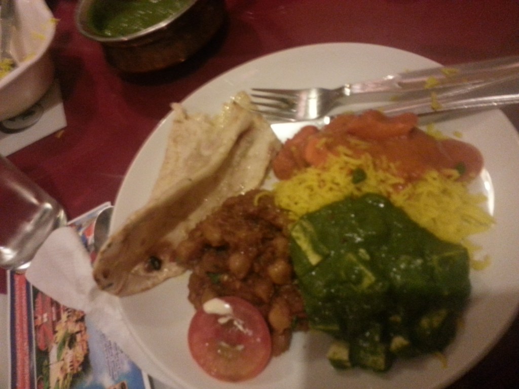
Indian food – butter chicken, palak paneer, chana masala, naan,
Khmer food (including the national dish – Fish Amok)
Khmer fusion food from a local NGO restaurant, Friends
The best pizza and ribs in Phnom Penh, at Brooklyn Pizza
Breakfast (pancakes, eggs, bacon, etc)
Fruit shakes
Western Food, served almost everywhere
Ice cream (and lots of it!)
In particular, we developed a bit of an obsession with Swensen’s ice cream. Swensen’s is an ice cream chain originally founded in San Francisco. It’s really shilling Americana, so much so that we had thought it was a chain from Singapore, but according to Wikipedia, it’s actually owned by a conglomerate headquartered in Markham, ON (apparently Burger King isn’t the only corporation that knows about Canada’s low corporate taxes). In any case, Swensen’s has a sizeable presence in the Asian markets, but sometimes that presents its own challenges, but also leads to hilarity.
In Siem Reap, we’d seen a sign for Swensen’s, but couldn’t find it on Google Maps. Being North American, I thought “hey! I’ll just check the Swensen’s website!”. Ha! On the Swensen’s website, selecting “Cambodia” opens an email window for you to send an email to the Cambodian franchise owner to find out where they have locations. Not exactly the instant information that I was looking for. Anyways, we ended up finding it by accident, around the corner from our hotel.
On our first trip there, Kevin and Kristopher were dismayed to learn that they were unable to make a few choice desserts due to lack of supplies (certain chocolate ice creams, and also maltesers). Of course, Kevin solved the latter issue by going to the grocery story, 10 feet away, and buying a pack of maltesers. Much laughter ensued.
As for our expensive Italian food – after we returned from Siem Reap, I asked (re: instructed) Tyler to choose a place for us to eat dinner the next night. Kevin and I had been doing all the research and making all the decisions, so I figured it would be good for Tyler to get a taste of that. After some research, he recommended we go to Do Forni, an Italian restaurant at Sofitel, a top Phnom Penh hotel. TripAdvisor said it was 2 dollar signs, so away we went. It was very much very fancy. It was maybe 2 dollar signs (out of 5) by Toronto standards, but it was definitely the most expensive restaurant we’ve been to in Phnom Penh (that is, a dish cost between $15 and $30). That said, the food was delicious (we had steak, lobster ravioli, pizza, carpaccio, wine) and the service was also very good. And of course, the restaurant itself was beautiful. Tyler was generous enough to pick up the tab, proving once again that he is the superior sibling in this mix.
On our second day in Siem Reap, we decided to go on an adventure off the beaten trail. Kevin had done his research (as per usual), and he lead us on an adventure to a remote and unique temple called Beng Mealea. Remote because it’s approx. 60km away from Siem Reap, and unique because it’s in a far more ruinous state, despite being quite a large and impressive site.
Here’s a bit of background on Beng Mealea, brought to you by the Boston Globe’s David Abel:
A precursor to the temples throughout the Angkor Wat complex, Beng Mealea spreads over several acres of jungle, with a series of so-called libraries, courtyards, and other chambers that surround a sanctuary, much of which are covered in carvings from Hindu and Buddhist mythology.
Unlike Angkor Wat, the remains here have been neither renovated nor preserved. As a result, most of the buildings have been reduced to large piles of moss-covered stones, with trees and ferns rising through the yawning crevices where the foundation once stood. The columns have been reduced to rubble, and the entire area is a danger zone of sharp edges and knotty roots twisting over the stone.
There are no signs explaining why the temple remains in such decrepitude, but there are many guides eager to offer their explanations and provide private tours. (Abel, Boston Globe)
We were picked up by one such guide: an older, yet very spry woman who practically held my hand the entire time, as we climbed up and down the ruins of Beng Mealea. Most of the temples we’d already seen had been largely intact, or at least so intact that one wouldn’t consider walking on the more treacherous parts. Sometimes the more fallen-down parts of the temples had been blocked off as a no-walking zone. As we entered Beng Mealea, I spotted a raised bridge, with ruins below. I started along the bridge, thinking that we’d just walk above the ruins – ha. Not so fast.
Our guide quickly guided us off the bridge, to instead walk along a ledge around the side of the temple. She then pointed us to walk INSIDE the temple, crawling across, up, and down the piles of stones all throughout the ruins. Our tour continued like this the whole time. This place was just incredible. The size alone is stunning, but the level of detail, the fact that it’s so old, and you’re walking around inside literally incredible history – it’s all just too much. And just when you’re completely blown away by the man-made structures, you notice the out-of-this-world trees that are slowly taking over, growing in the most incredible and beautiful ways. Seriously. I have never seen such amazing trees as I did at Beng Mealea.
In all of this, we were very lucky to have a guide, as she led us to many beautiful sites we’d have missed on our own. After the tour, she then pointed us in a direction where we could continue to adventure. That’s also when Kevin pointed out that the 60+ year old woman who had to help me climb around this whole temple actually had a prosthetic leg. I really reevaluated by ability to carry myself around at that point in time – being less able to climb things than a one-legged grandma is a bit of a wake up call. Still, without her to hold my hand and help me up and down, I instead relied on Tyler to coach me through the places I was nervous about walking, so I didn’t adventure quite as far as Kevin and my brothers. Instead, I was able to sit and just take in the beauty and solitude of my surroundings.
There aren’t really words to describe this place, so just take a look at the photos below, and then book your own ticket and see it for yourself!
As Kristopher pointed out, the Angkor temples that we saw were actually amazing. That is, while the word ‘amazing’ is frequently used, it rarely describes things that amaze people, but when you talk about Angkor Watt and surrounding temples, you’re really describing history and buildings and architecture as “amazing” because you really are amazed.
We had a long journey that day, in the hot, hot, heat of Cambodia. Have you ever sweat so much that you didn’t have to pee, despite drinking several bottles of water? Because that’s how much we sweat. It was gross, and it was worth every bit of it.
Before I go on and on about what we saw and how incredible the Angkorian temples were (plus maps!), here’s a brief backgrounder from UNESCO:
Angkor, in Cambodia’s northern province of Siem Reap, is one of the most important archaeological sites of Southeast Asia. It extends over approximately 400 square kilometres and consists of scores of temples, hydraulic structures (basins, dykes, reservoirs, canals) as well as communication routes. For several centuries Angkor, was the centre of the Khmer Kingdom. With impressive monuments, several different ancient urban plans and large water reservoirs, the site is a unique concentration of features testifying to an exceptional civilization. Temples such as Angkor Wat, the Bayon, Preah Khan and Ta Prohm, exemplars of Khmer architecture, are closely linked to their geographical context as well as being imbued with symbolic significance. The architecture and layout of the successive capitals bear witness to a high level of social order and ranking within the Khmer Empire. Angkor is therefore a major site exemplifying cultural, religious and symbolic values, as well as containing high architectural, archaeological and artistic significance. (UNESCO)
To learn more, I highly recommend that you check out the article yourself to read the Long Description and learn a bit more about Khmer (Cambodian) history.
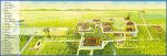
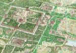
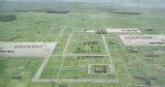
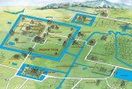
Below are some maps to give a sense of how things are laid out. The East and West Barays are sometimes presented as bodies of water (especially on Google Maps), but they’re really wetlands that now exist where the Angkorian Empire had created man-made lakes. If this mixed presentation of maps sounds confusing, that’s because it is. Google Maps accuracy was not great during this trip.
Here’s a map of the adventure we took, to be followed by stories.
Around 10am on Saturday morning, after eating breakfast at our hotel, we loaded ourselves up on our motorcycles and headed off. Not so fast though – the Page kids had some difficulty getting started.
Problem 1: the motorcycles were too tall for me! It probably took me 5 minutes to figure how to actually get on the back of Kevin’s motorcycle. It involved much hysteria (on my part), and much encouragement, then frustration, then encouragement (on Kevin’s part). These motorcycles have quite a bit of suspension, to make for better riding on bumpy roads, but the suspension also makes the bikes quite a bit taller than your average motorcycle.
Problem 2: Tyler’s motorcycle wouldn’t start. Kevin and I had already gone half a block, but it was clear Tyler’s bike wasn’t starting. We circled the block, got off of Kevin’s motorcycle (also difficult), and Kevin started Tyler’s motorcycle with his magical skills. Then it was back on the motorcycle (only slightly less difficult the second time around), and set off on our day’s adventure.
From the middle of Siem Reap, we rode about 15 minutes to the ticket booth for Angkor Archaeological Park, bought our tickets, and rode another 15 minutes to Angkor Watt. This distance was the reason we opted to explore Angkor via motorcycle and not actual bicycles.
We then arrived at our first stop, Angkor Watt, where I was promptly convinced to buy a $10 scarf from a local. She assured me that it was 100% necessary to wear one in the temples. So, I bought this overpriced scarf (despite having 3 scarves in my suitcase at the hotel! I am a fool.) to wrap around my bare legs, and then spent the next hour carrying it around. I felt a bit better when I was asked to put it on to get into the main temple eventually, though I didn’t feel better when I saw a different lady selling the same scarf for $3.
Angkor Watt was incredibly large and impressive and beautiful and detailed. And then, when we looked up, we saw a ring rainbow around the sun!! We took an outrageous number of pictures, and Kevin also captured a video of us attempting to take a “jump” photo:
After spending more than an hour exploring the beauty of Angkor Watt, we made our way back to our motorcycles and headed north of Angkor Thom. We stopped at the Bayon Temple, which had been the focal point of Angkor Thom, and spent quite a bit of time walking around feeling like we were in the 90s video game, PitFall. The Bayon sits in the middle of a ring road, so we were able to film the temple as we drove around the full circle:
After Angkor Thom, we decided to take a bit of an adventure detour and head over to West Mebon, a temple in the middle of a lake. It seemed to be just a quick side-road jaunt away. We headed west out of the Angkor Thom complex, then a bit north. As the navigator, I was in charge of getting us there, and I had a pretty good handle on things. That is, until we came to a fork in the road and I chose the road that looked more serious (that is, the road that wasn’t just a thin road through a village). Once I realized I’d chosen wrong, I figured “hey, no big deal, we can take one of the many side roads that connect back to that village road!”. The first few “side roads” looked more like “side walkways” so we passed them. Finally we found a road that looked not too bad. It was so not-too-bad that it actually took us to someone’s house. And then we had to drive over their concrete side-yard to reach a path behind their house. That should’ve been a sign of things to come.
We waved to the children, and ignored the concerned look on the face of the old man waving at us. Also a sign.
The path started out okay. We passed a 5 foot ditch, we passed through a portion of path with barbed wire on both sides, but we were surviving. Then, we started to go uphill. Just as I was realizing “shit, this road is totally not a road and all I see ahead is jungle”, I realized that our bike was falling to the side and Kevin was yelling. We were now both standing on one leg, in a bush, straddling this too-tall bike. Somehow I managed not to get burned, and once I heard Kevin yelling “get off the bike, I think my leg might break soon”, I pulled my left leg into the bush, tried to hold up the bike so all the pressure wouldn’t be on Kevin and his right leg, and yelled for Kristopher to come help us (He and Tyler were stopped, safely, 10 feet behind us). Kristopher lifted the bike, and Kevin swung his left leg back off the bike to stand in the bush as well, leg intact. Our adventure on this non-road was over.
KP and I walked back, as Tyler and Kevin manoeuvred and their bikes back to the house, and back to the comparatively very real part of the side-road-path. We didn’t see that old man who’d likely warned us, but I’m sure he’s seen others make the same mistake, and it’s likely he’ll see more in the future.
Not content to quit just yet, we made it back to the main road, and tried another side road. About ten seconds into that, we realized it was too sandy for safe riding, and promptly turned around. “We’ll just google this one to see if it’s worth it”, was our resolution. Here’s the result, btw. It seems pretty awesome, but we didn’t have time to return the next day.
So, fully humbled, we rode the motorcyles back through Angkor Thom, and headed north, then east, then south, to see a variety of interesting temples. The last one was probably our favourite of the day – Banteay Kdei. It was a lot more ruin-y than the others, and it was punctuated by enormous, incredible trees growing out of everything.
Check out our many, many photos from the day. Then, book your ticket to Cambodia so that you can see these for yourselves. SO worth it. (PS: I’ll have more photos coming in the next few days from this particular adventure, as Kevin’s phone died in the afternoon, and only Tyler and Kristopher have photos from certain temples.)
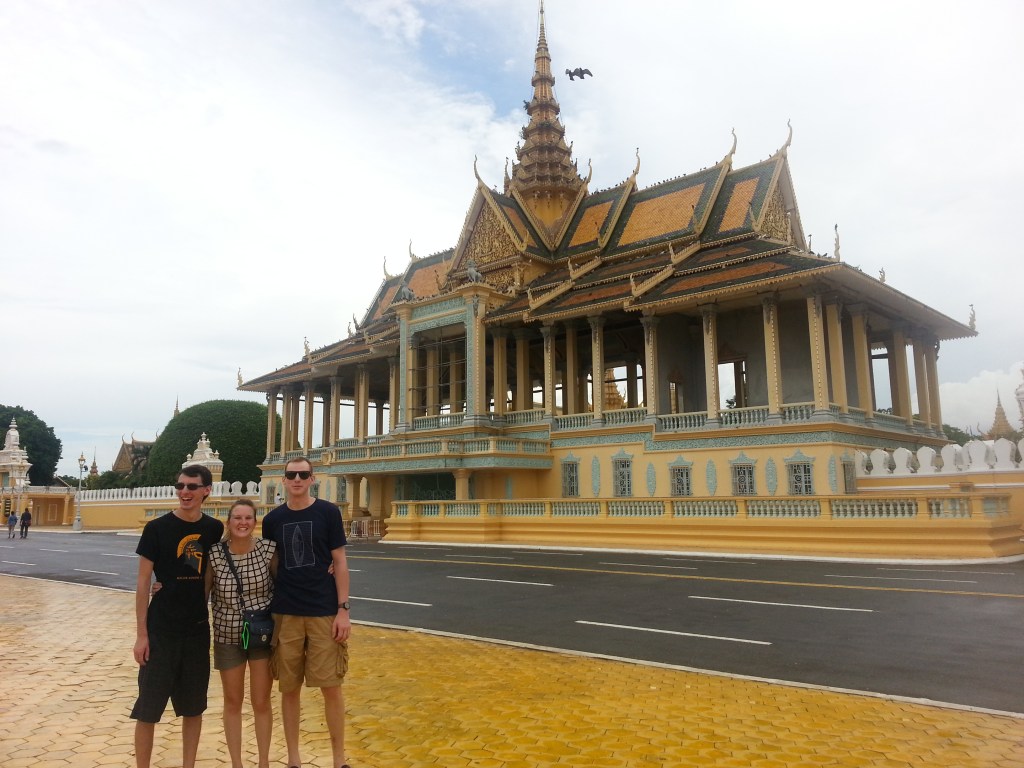
the Page kids at Angkor Watt
rainbow sun circle!
our first series of band photos
temple carvings
more band photos
Climbing up to the main temple of Angkor Watt
Tyler making good use of my new scarf
Feet in the middle at the Bayon Temple at Angkor Thom
In November of last year, Tyler and Kevin took a motorcycling course to get their formal M2 license for riding a motorcycle in Canada. After a long hiatus, they decided to put those skills into action in Cambodia. Riding here is not at all like riding in a parking lot in Scarborough, and they’ve got the photos to prove it. (Disclaimer: Kevin has been riding a motorcycle since he was approx 15, so he was the experienced safety captain of this operation – leading, worrying, and teaching Tyler the ropes of countryside riding).
My brothers were visiting us here for 10 days, which encapsulated only one proper weekend. We spent that weekend in Siem Reap, visiting the various incredible temples and history of Angkor (more to come on that). To get there, Kristopher and I hopped on a 6 hour air-conditioned van ride. Meanwhile, Tyler and Kevin rented motorcycles for the weekend, and they met us Siem Reap after a 7 hour trek through the countryside traffic of Cambodia (in 37 degree heat!).
I asked Kevin to tell me what the riding was like and he said this:
After riding motorcycles on three different continents, I can say that our Cambodia trip was the dustiest and hottest that I’ve yet to contend. When there was a road surface it was slippery, and when there wasn’t a road, the scene was littered with massive potholes and the dust gave close to zero visibility. No gas bar service stations to be seen! While I was a bit nervous taking Tyler out at rush hour, there’s nothing better for learning than being thrown into the frying pan like that. This is an experience that couldn’t be replicated in North America or Europe. Tyler performed well and I’m looking forward to our next road trip.
The great thing about them riding motorcycles to Siem Reap was that the 4 of us were then able to motorcycle all around the Angkor temples together. With me giving directions à la Kevin’s cell phone, we were able to get around and remain independent. I was also able to capture a couple of videos of my brothers doing some very cool things. This, for example:
After two days of driving KP and I all around, Kevin and Tyler rode back to Phnom Penh on Monday morning.
Of course, while KP and I spent our trips there and back watching the Simpsons on my laptop, their trip was much more eventful. It included buying gas out of glass bottles from a woman sitting on the side of the road, getting completely covered in red clay from the unpaved roads, dealing with Cambodian traffic (re: left hand turners driving in the oncoming lane to reach their destination), chickens on motorcycles, kids and adults alike staring at them and wishing them “good luck”, and a little bit of rain. At one point they met some kids when they stopped to eat their snacks. They offered some cookies to the kids, who then walked away with the whole box – cookie bandits!
The end result of all this? Some good stories to tell, and approx 1000 more kilometres of motorcycling experience under their belts.
Check out the photos of their bad-assery below:
Tyler, leaving the city at rush hour
Buying roadside gas – 1 USD per litre.
“What did you make me do Kevin”
“Let’s call Heather to pick us up, er no phone service”
“This bike is way too tall for me, beggars can’t be choosers”
Leathers aren’t cool here…
I wish I had leathers.
Not the regional roads of Ontario
Buying roadside snacks – these kids took their cookies!
Locals stop and stare
The guy working at the gas station gave them free bottled water and wished them good luck.
Approaching the chicken man
Sporting a breathing mask to keep out dust
250cc Honda is all I need
We also saw the chicken guy in Phnom Penh – here’s a close up of what Tyler and Kevin also saw from the road.
Before my brothers arrived, we’d been really saving up the “touristy” activities that we wanted to do, so that the four of us could experience such things with maximum enthusiasm.
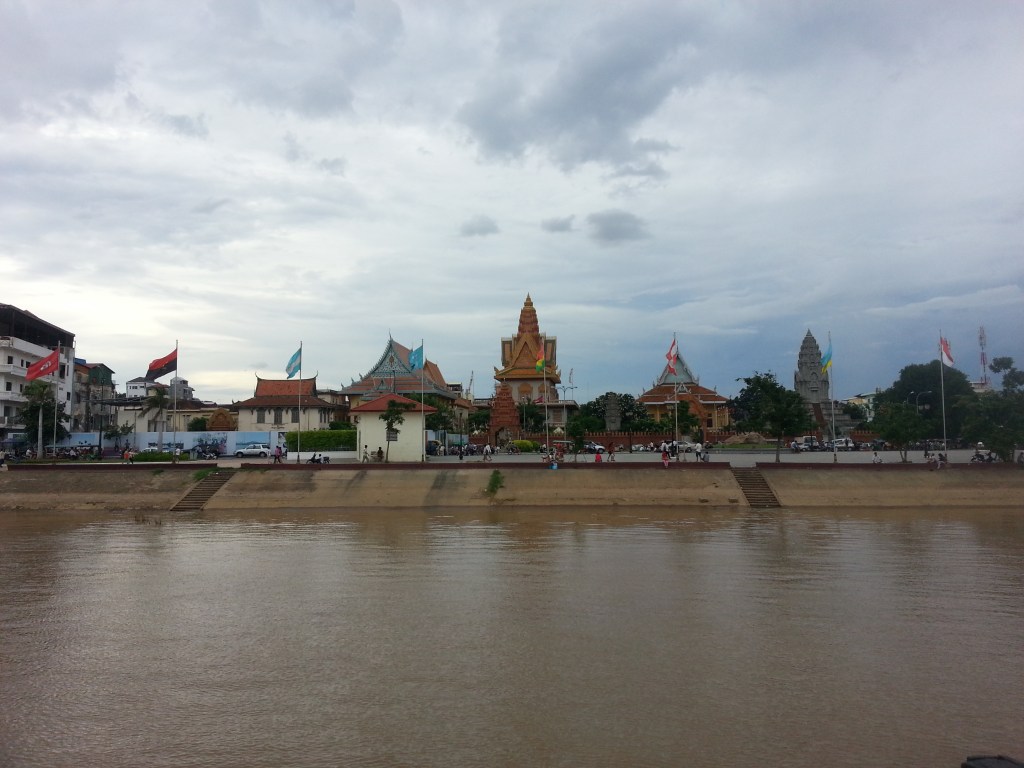
One of the things we’d been most looking forward to was a boat tour on the Tonle Sap and Mekong rivers. Kevin did his usual helpful research and found us a great yet simple boat tour – 1.5 hours, free beer, on a boat just before sunset.
We stood on the roof of a lovely boat with our two tour guides, who told us all about the culture, architecture, changes, and politics of Phnom Penh and the surrounding waterfront communities along the rivers. We were also able to see the Floating Village on the Mekong – houses that sit on bamboo and which rise and lower with the tide. Very cool stuff.
We did our boat tour with Memorable Cambodia, and I’d recommend them to anyone. You can check out their website right here.
Those of you who know my middle brother, Tyler, know that he’s a diehard hockey fanatic. Like, the whole nine yards – he plays (usually year round), he coaches, he watches, he consumes, and he knows an INSANE amount of information about this sport. Like, if I knew as much about politics as he does about hockey, I’d be in the House of Commons by now.
So, when he was planning his trip to Cambodia, he googled “hockey in Cambodia” to see if he’d get any results back. And he did! As it turns out, for the last 10 years a rotating group of ex-pats and Khmer locals have been meeting weekly on a tennis court in the BKK neighbourhood to play ball hockey.
They bill this as Hockey Night in Cambodia, and they meet up every Thursday at 7pm on the tennis court beside BKK Secondary School (across the street from City Villa hotel on Street 71).
Their website gives the wrong address, so at first we weren’t sure if we’d be able to find the proper location, but google saved us again, and we made it to the game!
Kevin and Tyler played while KP and I cheered from the sidelines. Check out the photos and video footage below:
Be sure to also check out the Hockey Night in Cambodia website and Facebook page!
Quick update: they’ve arrived safely and survived for almost 24 hours here. It still seems a bit bizarre that they’re in Cambodia, but I’m very happy to see them. More stories and photos to come, but for now, here are just a few photos of the Page family+Kevin reunion in Phnom Penh:
After leaving Nacpan Beach, we took a bus down to the Palawan capital of Puerto Princesa, where we were scheduled to catch a flight back to Manila. So, we boarded an air-conditioned van that took us on a 7 hour bus ride, despite telling us it would be 4.5 hours. But hey – rain, a flat tire, and slow-moving fellow passengers get in the way of schedules sometimes. Anyways, Puerto Princesa bills itself as “a city within a forest”, and while we didn’t see much of the city, we did check out the area’s main attraction – the Underground River.
This included a wild van ride through the forest to get to said attraction, followed by a boat ride inside extensive caves underneath the mountain where the Underground River flows. I’m sure there was a lot of science-y facts to be learned about this place, but we didn’t learn any of them on our tour. Here’s what the UNESCO website has to say:
“Puerto-Princesa Subterranean River National Park encompasses one of the world’s most impressive cave systems, featuring spectacular limestone karst landscapes, pristine natural beauty, and intact old-growth forests and distinctive wildlife. It is located in the south-western part of the Philippine Archipelago on the mid western coast of Palawan, approximately 76 km northwest of Puerto Princesa and 360 km southwest of Manila.
The property, comprising an area of approximately 5,753ha, contains an 8.2km long underground river. The highlight of this subterranean river system is that it flows directly into the sea, with its brackish lower half subjected to tidal influence, distinguishing it as a significant natural global phenomenon. The river’s cavern presents remarkable, eye-catching rock formations. The property contains a full mountain-to-sea ecosystem which provides significant habitat for biodiversity conservation and protects the most intact and noteworthy forests within the Palawan biogeographic province. Holding the distinction of being the first national park devolved and successfully managed by a local government unit, the park’s effective management system is a symbol of commitment by the Filipino people to the protection and conservation of their natural heritage.” (UNESCO)
Our tour went more like this:
“That rock, up there, looks like the Virgin Mary”
“That formation ahead looks like carrots”
“If you look to the right, you’ll see it looks like garlic”
“Again, that to the left looks like the Virgin Mary”
“Up at the top, those formations, they look like the Last Supper”
So, not very scientific, but quite entertaining. The caves were really stunning; also, filled with bats. I did get some bat poop in my hair but fortunately none in my mouth – apparently that actually happens to people sometimes.
This video does a pretty good job of showing what the canoe right into the caves looked like:
Below we have photos of Kevin playing with Mimi the cat at our hotel, the scenery on the way to the Underground River, and photos of us at the Underground River with our friend Breann (who we met on our crazy van ride). Check it out!
Towards the end of our time in El Nido, we spent a day out at Nacpan Beach, a remote beach 45 minutes north of El Nido. We went to buy some coconuts, and the lady at the kiosk told us we should check out some rentable cottages further down the beach. So, coconuts in hand, we did just that. Nacpan beach is pretty spectacular, and the cottages were also pretty cute, so we changed our travel schedule, and decided to leave El Nido a day early to spend 2 nights at “Jack’s Place”. Getting there is pretty harrowing 45 minute tricycle ride, but it’s well worth it. Even Kevin says it’s the best beach he’s ever seen, and this guy knows his beaches.
First, we spent a day there before heading back to El Nido and checking out of Golden Monkeys. That day was amazing, and for the first time ever we saw cows on the beach (see photos below).
We returned the next day for two nights. That first afternoon was incredible, though that first night was a bit messy. Kevin and I set up the mosquito net completely wrong, and it ended up laying directly on top of Kevin for most of the night. This meant that he was bitten by mosquitos all over this body, and after he woke up realizing this around 3am, that was the end of sleep for the both of us.We spent the next few hours curled up in awkward positions with a way-too-hot blanket on top of us for protection. When the rose and the bugs subsided a bit, we headed outside to sleep in hammocks near the beach. A couple of hours later, we grabbed a bit more sleep back in bed. So, that was an awful few hours, but being in paradise more than made up for it. Lesson learned? When it comes to setting up mosquito nets, always ask for help.
We spent our days on the beach and in the ocean. Not having spent much time in the ocean as a kid, I had a lot to learn. Like, how to jump into waves. How not to get knocked over. I did lose my sunglasses, but other than that I’ve adapted well.
Jack’s Place only had power from 6pm to 9pm, so we took advantage of that time to hang out in a common area with a wonderful Swedish couple who were traveling in the region. There’s something interesting about living by the natural sunlight, and that something includes going to bed earlier than usual. In spaces like that, the company of other people felt especially valuable, and we welcomed gladly their conversation and card games.
Check out the photos below! There was more nature than we’ve captured here (chickens, dogs, ox, pigs, running around all over the place), but Nacpan is so lovely that even our photos can show it.
Cheering on LP and the WeatherTech Car from the beach!
Inside our cottage
Our new cottage
The view from our cottage – yes, that’s an ox pulling a cart in the distance
tanning away – can’t you tell how tanned I am??
we couldn’t get enough of this.
Me, sunscreening before continued suntanning
Again, Kevin making wacky jokes to crack up my brothers
These cows peed beside our towels, and then headed to a little pool for a drink
Beach Selfie, no #selfiestick needed
Nacpan beach – the island in the distance is owned by Manny Pacquiao
A couple of days after Anne had left us for Manila, Kevin and I signed up for a big group tour through Art Cafe. This time, we embarked on Tour B. The food wasn’t as good with the Art Cafe tour as it had been with the Golden Monkeys Tour, but the content of the tour was similar, as it’s a standard experience.
I think we preferred our smaller tour with Anne and Loc, but being in a big group had its own advantages. For one, we got to check out how some other experienced travellers did things. Apparently everyone except us got the memo that it’s essential to have a waterproof travel bag to hold all your stuff on the boat. Kinda like this version from MEC. It’s not really essential, but it definitely would’ve been nice, and would’ve kept our stuff a bit drier/sand-free.
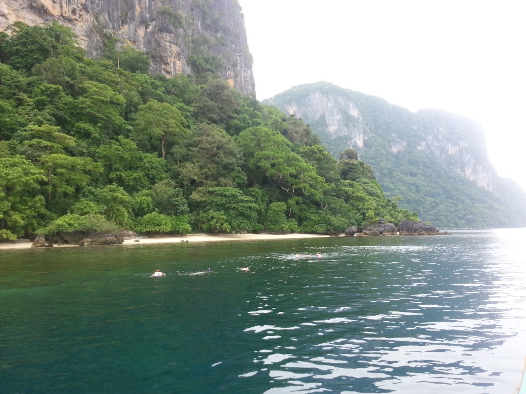
We had expected Tour B to have more beaches, but instead it was heavy on snorkelling. Kevin’s not really into snorkelling, so he worked on his tan from the boat, while I snorkeled around looking for cute fishes and what not. Our photos really don’t do justice to the reality of how beautiful El Nido is. The highlight for us was Snake Island, of which Google has lots of great shots.
Aside from the natural beauty, we were pretty infatuated with the #selfiestick. You can read more about this phenomenon here and here, but essentially it was something we’d only heard about until the tour. Then, as we arrived at our first stop for a bit of snorkelling, Kevin and I turned around and watched in awe as the 5 other couples on our tour pulled out their Selfie Stick/GoPro combo. What’s a Selfie Stick? It’s a stick, with a camera on the end of it, that you use to take photos of yourself or your travels. From what we can tell, it was invented by GoPro, which makes a lot of sense, because I’m sure it didn’t take long for them to saturate the Extreme Sports Athlete market, and there’s nothing people love more than taking photos of themselves. It’s a handy camera for making underwater videos, but we also saw it used to take all kinds of other photos, including selfies. After that day, we saw them everywhere – I’m sure it won’t be long before they’re everywhere in North America. I’m expecting there to be a serious uptick in selfie-related injuries in the coming years.
Check out our photos below, taken with the traditional human arm/hand combo:
This little plant is shaped like a pepper, and it eats bugs that fly inside of it.
Standing on the sandbar leading to Snake Island
Some photos of Cathedral Cave
Kevin being a comedian. All such photos are staged with the purpose of making my brothers giggle.


")
")

")

")


")


")
")
")
")

")
")
")
")


")


")


")


