Tag: Ruins

  • Days 6 and 7 in Spain – Visiting the Mosque–Cathedral of Córdoba (the Mezquita)

    Days 6 and 7 in Spain – Visiting the Mosque–Cathedral of Córdoba (the Mezquita)

    The entire Iberian peninsula (inhabited for 1.2 million years) is full of complex history, and for a long time Cordoba was at the centre of some of the most significant events in the region.

    The Iberian peninsula (essentially the land that makes up Spain and Portugal) was inhabited by Romans in 112 BCE, and served as a resource centre for much of their empire (Wikipedia). The peninsula was conquered and re-conquered by many different groups after that time, but the glory of Cordoba began in 711 CE:

    In 711, a Muslim army invaded the Visigothic Kingdom in Hispania. Under Tariq ibn Ziyad, the Islamic army landed at Gibraltar and, in an eight-year campaign, occupied all except the northern kingdoms of the Iberian Peninsula in the Umayyad conquest of HispaniaAl-Andalus(Arabicالإندلس‎‎, tr. al-ʾAndalūs, possibly “Land of the Vandals”),[24][25] is the Arabic name given to what is today southern Spain by its Muslim Berber and Arab occupiers.

    From the 8th–15th centuries, only the southern part of the Iberian Peninsula was incorporated into the Islamic world and became a center of culture and learning, especially during the Caliphate of Córdoba, which reached its height under the rule of Abd-ar-Rahman III[citation needed]. The Muslims, who were initially Arabs and Berbers, included some local converts, the so-called Muladi. The Muslims were referred to by the generic name, Moors.

    The Wikipedia page on Cordoba goes into greater detail:

    Córdoba is a city in Andalusia, southern Spain, and the capital of the province of Córdoba. It was a Roman settlement. It was conquered by Muslim armies in the eighth century, and then became the capital of the Islamic Emirate and then Caliphate of Córdoba, including most of the Iberian Peninsula.

    Caliph Al Hakam II opened many libraries in addition to the many medical schools and universities which existed at the time, making Córdoba a centre for education. During these centuries, Córdoba became a society ruled by Muslims.[6] It returned to Christian rule in 1236, during the Reconquista. Today it is a moderately sized modern city; its population in 2011 was about 330,000.[7] The historic centre was named a UNESCO World Heritage Site.

    In May 766, it was chosen as the capital of the independent Muslim emirate of al-Andalus, later a Caliphate itself. By 800, the megacity of Cordoba supported over 200,000 residents – that is 0.1 per cent share of global population then. During the caliphate apogee (1000 AD), Córdoba had a population of roughly 500,000 inhabitants,[17] though estimates range between 350,000 and 1,000,000. In the 10th and 11th centuries, Córdoba was one of the most advanced cities in the world as well as a great cultural, political, financial and economic centre.[18] The Great Mosque of Córdoba dates back to this time. Upon a change of rulers, though, the situation changed quickly. “The vizier al-Mansur–the unofficial ruler of al-Andalus from 976 to 1002—burned most of the books on philosophy to please the Moorish clergy; most of the others were sold off or perished in the civil strife not long after.[19]

    In the ninth and tenth centuries, Córdoba was “one of the most important cities in the history of the world.” In it, “Christians and Jews were involved in the Royal Court and the intellectual life of the city.”[20]

    During the Spanish Reconquista, Córdoba was captured by King Ferdinand III of Castile on 29 June 1236, after a siege of several months. The city was divided into 14 colaciones, and numerous new church buildings were added.

    The city declined, especially after Renaissance times. In the 18th century it was reduced to just 20,000 inhabitants. The population and economy started to increase only in the early 20th century.

    The above-mentioned “Great Mosque of Cordoba”, the Mezquita-Catedral de Córdoba in Spanish, is the main event. Cordoba is a relatively small town now, and its skyline is dominated by the the Mezquita.

    On Sunday, visiting the Mezquita was our main goal, but we started out with a long walk. We stopped by a bunch of churches, and we also saw the site of an old Roman Temple. We also stopped for a delicious lunch at Norte y Sur Taberna Selecta.

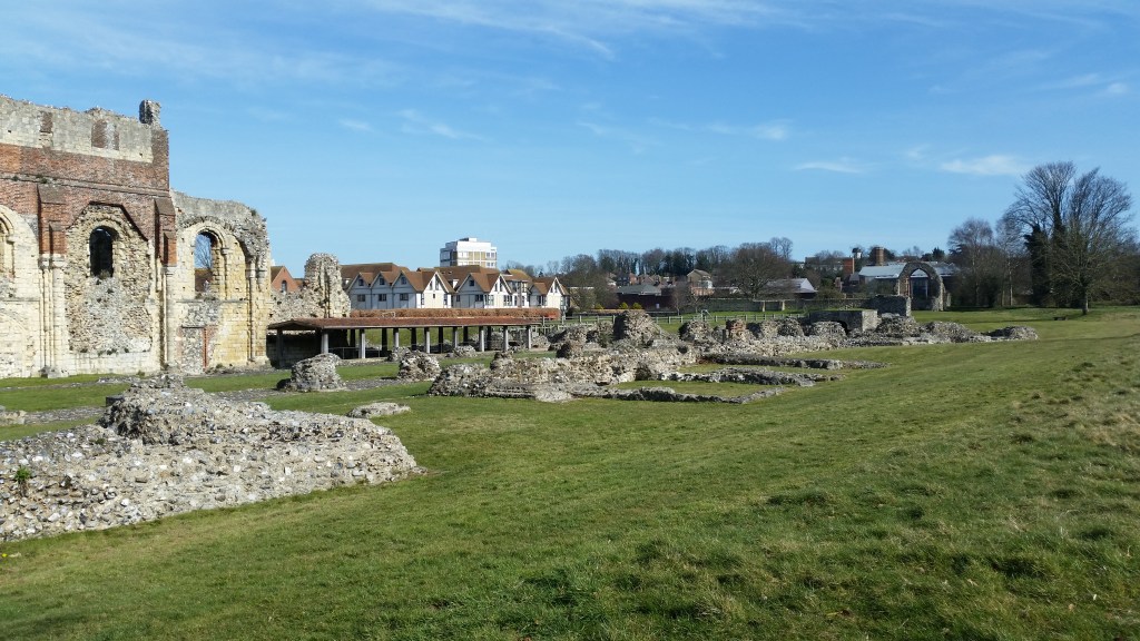
    Our walk took us through the ruins of the original entrance to Cordoba under Roman rule, and around the walls of the old city centre. We didn’t plan ahead, and most of the small churches and museums we wanted to go to were closed on Sunday afternoon. However, the Mezquita was opened, and in we went!

    This video is in Spanish, but it visually gives an understanding of how the Mezquita expanded over time.

    Here’s what we learned from the (extremely high quality) guide that they gave out at the entrance:

    This space has been home to a collection of buildings among which was thh Visigoth Basilic of San Vincente (mid-sixth century), which became the city’s main Christian temple. With the arrival of the Muslims the area was divided and used by both communities.

    Abd al-Rahman I built the original Mosque (786-788) in response to the growing population. Its floor plan includes eleven naves standing perpendicular to the qibla wall, with the central one being higher and wider than the side ones. Unlike other Muslim oratories, the qibla wall is not pointing towards Mecca, but instead faces south.

    The period of prosperity experienced under the government of Abd al-Rahman II led to the first enlargement (833-848). The prayer hall was extended with the addition of eight south-facing naves.

    Much later, in the year 951, the caliph Abd al-Rahman III began construction of a new minaret. This reached the height of 40 metres and inspired the minarets in the Mosques in Seville and Marrakesh.

    The Umayyad Caliphate saw the continuation of the period of political, social, and cultural splendour which led to the city replacing Damascus in terms of importance. Al-Hakam II carried out the second enlargement (962-966), the most creative of all.

    The final of the enlargements (991) was a demonstration of power by Almanzor, hajib of the caliph Hisham II. In this phase the site was extended towards the east by adding eight new naves.

    With the conquest of Cordoba in 1236 the Aljama was consecrated as a Catholic church, installing the main altar in the former skylight of Al-Hakam II. In 1489 adaptation of works were carried out to reflect the new religion with the construction of a Main Chapel. Once the Transept was completed in 1607 this space became known as the Villaviciosa Chapel.

    It was Bishop Alonso Manrique who ordered the building of the transept (1523-1606). The construction process was begun by Hernan Ruiz I in an imaginative way, combining the caliphal naves with the transept in the form of lateral naves. From the outside, the transept’s brickwork gives the building an appearance of verticality which contrasts with the horizontal sensation provided by the Mosque.

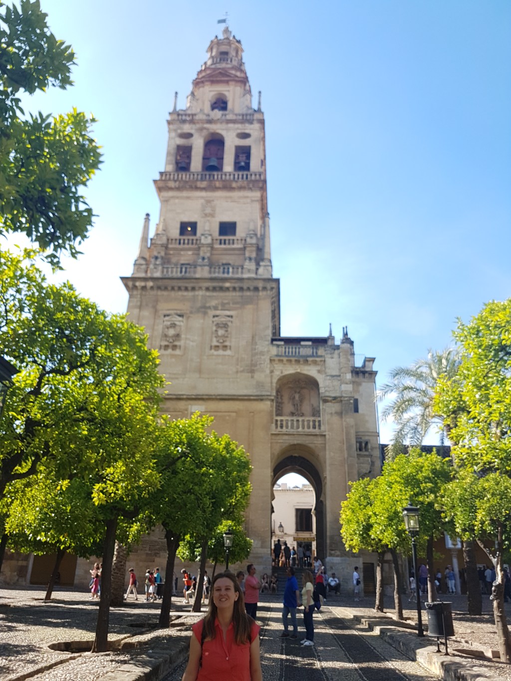
    You enter the Mezquita through the walled orange tree garden. It’s a beautiful and peaceful space, and a great lead-in for the Mezquita itself, which is an enveloping and calming building. Walking around, it’s frequently not possible to the end of the space, and yet the entire building is open concept, so the space feels endless. The scale of it all was remarkable, and unlike anything we’d seen so far.

    The Mezquita is at the heart of Cordoba’s history, and if you’re lucky to visit this city, it’s a definite must-see!

    After our time at the Mezquita, Kevin and I went to meet up with the rest of the group. We spent a couple of hours snacking and enjoying wine and each other’s company at a cafe in a plaza/square.

    To end the day, our group headed out to cross the bridge and see the view of the city from the other side of the Roman bridge. Our second day was wrapping up, and while we didn’t get to see everything, but we felt like we had seen enough to appreciate the magic of Cordoba.

    Many, many photos below from our hours-long walk through the city.


  • Road Trip Day 3: Evora & Illness & the Algarve

    Road Trip Day 3: Evora & Illness & the Algarve

    After waking up in Marvao and spending our morning exploring, we set off to Evora. Of course, Tyler rolled his ankle on those beautiful cobblestone streets the night before, and I woke up feeling the beginning of a fever. Still, we had 2 more stops on our road trip, beginning with the city of Evora, followed by the nearby Monsaraz, then the city of Beja. By the time we had lunch, Kevin realized his couple of Pages were too ill, and he promptly drove us the last 3 hours home to the Algarve.

    Before our trip was cut short, we did get to explore Evora. We also had an incredible lunch at a restaurant that only serves 9 people at a time. “Botequim da Mouraria” is run by a welcoming Portuguese couple. In their small restaurant, there’s bar seating only, which means that we were incredibly lucky to arrive in time for lunch and find 3 empty chairs waiting for us. The service and the food were excellent. This was one of those places Kevin had found in the course of his detailed research, and it was very much worth the hype.

    After lunch, we explored Evora and its incredible history. A very old city, Evora still has Roman ruins and an incredible variety of historic architecture. On all our other stops, I read aloud to the guys various historical fun facts. Being sick in Evora meant that I didn’t really do this, and so we learned a bit less there than everywhere else. The city is more than 2000 years old, and was occupied by the Celts and the Moors before becoming the #2 city in Portugal for a time, becoming the site of much lavish spending on the behalf of Portuguese rulers.

    Here are a couple of other fun facts about Evora:

    Évora has a history dating back more than two millennia.

    It was known as Ebora by the Celts, a tribal confederacy, south of the Lusitanians (and of Tagus river), who made the town their regional capital.

    The etymological origin of the name Ebora is from the ancient Celtic word ebora/ebura, plural genitive of the word eburos (yew), name of a species of tree, so its name means “of yew tree.” The city of York, in northern England, at the time of the Roman Empire, was called Eboracum/Eburacum, named after the ancient Celtic place name Ebora Kon (Place of Yew Trees), so the old name of York is etymologically related to the city of Évora.[6]

    (Wikipedia)

    Évora is also remarkable for reasons other than its monumental heritage related to significant historic events. The 16th century was a time of major urban planning and great intellectual and religious influence. While Évora also has many noteworthy 16th-century patrician houses (Cordovil house, the house of Garcia de Resende), the unique quality of the city arises from the coherence of the minor architecture of the 16th, 17th and 18th centuries. This unity finds its overall expression in the form of numerous low whitewashed houses, decorated with Dutch tiles and wrought-iron balconies and covered with tile roofs or terraces which line narrow streets of medieval configuration and which in other areas bears witness to the concentric growth of the town until the 17th century. It also served to strengthen the fundamental unity of a type of architecture that is perfectly adapted to the climate and the location.

    Évora remained mainly undamaged by the great earthquake of 1755 that destroyed many towns in Portugal, including Lisbon. The monuments of the Historic Centre of Évora bear witness to their profound influence on Portuguese architecture in Brazil.

    (UNESCO)

    In retrospect, while we recognized how beautiful Evora was, I was a bit too sick to recognize and appreciate the signs of its long storied history. It was also clearly packed with tourists from all of the world, which became a bit of a distraction itself. All the same, we managed to take a few photos. Enjoy!


  • Roadtrip Day 2: An Aqueduct “just around the corner”

    Roadtrip Day 2: An Aqueduct “just around the corner”

    While we were visiting the Convent of Christ in Tomar, the map of the site said that there was an aqueduct attached. Tyler was pretty excited about this, never having seen a real aqueduct. Kevin and I had seen some in Lisbon, but agreed that it was pretty cool.

    While Tyler and I searched for the aqueduct ruins (which we found outside, attached to the Castle of Tomar), Kevin searched on Google. When we were done at the Castle/Convent, Kevin said he had one more stop he wanted to make. He handed me the phone with a seemingly random spot marked on the map nearby. He told me what we were up to but hadn’t said anything yet to Tyler.

    5 minutes of driving later, we came to the Pegoes Aqueduct, to which the aqueduct ruins at the castle were attached.

    But rather than just a couple of arches, what we saw was a full aqueduct crossing a valley. And the best part? It was open and also empty! From where we parked, we walked just a few steps to climb up onto the aqueduct through an old water inspection station. In the silent countryside, we walked along an ancient aqueduct, just the 3 of us.

    A quick little surprise, and one of the highlights of our trip. Enjoy the photos below!

  • Roadtrip Day 1: A Moorish Castle and Palace of Pena

    Roadtrip Day 1: A Moorish Castle and Palace of Pena

    We typically take our sweet, sweet time when doing anything, but because we were on a road trip, we had certain goals for where to be and when to be there by. We were also exploring unfamiliar territory, and perhaps underestimated how much time we’d want to spend in certain places.

    That said, everything that we saw on the first day of our Road trip was within the magical area known as Sintra, where castles and natural beauty abound. There are tons and tons of incredible sites to see in Sintra, but we oriented our trip to the advice of our friend Soledad, and selected those she described as ‘must-see’ items.

    We visited 2 different castles on that day, and they couldn’t have been more different: The Moorish Castle, and Palace of Pena.

    Let’s start with the Moorish Castle.

    The Moorish Castle was the decidedly more ruin-y of the two. It is a military fort built around the 10th century by the Muslim populations that occupied the Iberian peninsula. It acted as a control tower for the Atlantic coast and land to the north, serving as an outpost for the city of Lisbon.

    For a building that’s more than 1000 years old, it was in pretty decent shape. All of the exterior castle walls remain, and we were able to walk up, down, all around, and catch amazing views throughout. From the top of the castle walls, you can see all that’s built up in the Park in the centuries since: a town, castles, mansions, etc. And yet, you can imagine how it felt 1000 years ago to look out and see no evidence of other people. Placed atop a large hill, this place is definitely an impressive and well planned military location.

    And not *just* military either. After the large castle walls had been built, people began to settle just outside of them. A “second circle of walls” was later built to protect these settlements.

    If you’re interested in the nitty gritty history timeline for the Castle of the Moors, check out Wikipedia.

    After the Castle of the Moors, we headed to the Palace of Pena.

    While it was cool, the Palace of Pena (Palacio da Pena) is one road trip stop we could’ve done without. We crammed a lot of sites into this road trip. That’s not usually our style, but we went a bit overboard with expectations for what we wanted to see. In its defense, it’s part of a large garden complex, but we only saw the castle itself, because it was raining and we were rushing to see another place afterwards (more on that later this week!). By rushing to see the Palacio, we cost ourself some appreciation of its history. The routinely under-informational museum pamphlet also didn’t give us the full story of site.

    Here’s what Wikipedia has to say:

    The palace’s history started in the Middle Ages when a chapel dedicated to Our Lady of Pena was built on the top of the hill above Sintra. According to tradition, construction occurred after an apparition of the Virgin Mary.

    In 1493, King John II, accompanied by his wife Queen Leonor, made a pilgrimage to the site to fulfill a vow. His successor, King Manuel I, was also very fond of this sanctuary, and ordered the construction of a monastery on this site which was donated to the Order of Saint Jerome. For centuries Pena was a small, quiet place for meditation, housing a maximum of eighteen monks.

    In the 18th century the monastery was severely damaged by lightning. However, it was the Great Lisbon Earthquake of 1755, occurring shortly afterwards, that took the heaviest toll on the monastery, reducing it to ruins. Nonetheless, the chapel escaped without significant damage.

    For many decades the ruins remained untouched, but they still astonished young prince Ferdinand. In 1838, as King consort Ferdinand II, he decided to acquire the old monastery, all of the surrounding lands, the nearby Castle of the Moors and a few other estates in the area. King Ferdinand then set out to transform the remains of the monastery into a palace that would serve as a summer residence for the Portuguese royal family. The commission for the Romantic style rebuilding was given to Lieutenant-General and mining engineer Baron Wilhelm Ludwig von Eschwege. Eschwege, a German amateur architect, was much traveled and likely had knowledge of several castles along the Rhine river. The construction took place between 1842–1854, although it was almost completed in 1847: King Ferdinand and Queen Maria II intervened decisively on matters of decoration and symbolism. Among others, the King suggested vaul tarches, Medieval and Islamic elements be included, and he also designed an ornate window for the main façade (inspired by the chapter house window of the Convent of the Order of Christ in Tomar).

    Having done my Wikipedia research, it’s clear that this place’s history actually fits well with many of the other sites that we saw in Sintra and in Tomar. That information was definitely not in the pamphlet we received upon entering, but either way we had a fun time. It’s by far the most colourful castle I’ve ever seen, which gives it an almost-comical appearance.

    All this site-seeing constituted just part of our day. Enjoy the photos below, there’s more to come from our final (and favourite!) stop coming soon.


  • Lunch at Palacio do Estoi

    Lunch at Palacio do Estoi

    Sometimes being in Portugal with Kevin feels like being on a non-stop field trip. That is to say, he’s always cooking up new ideas and trips and adventures to keep me entertained. Back in February, Kevin planned a whole-day outing for us to see the Palacio do Estoi (aka the Palace of Estoi). Our drive to Estoi wasn’t your regular ol’ highway drive. Kevin chose the most scenic route possible, and included a stop in the nearby town of Salir, where a sign promised us castle ruins.

    Salir really was beautiful, and as it sits on a top of a hill, it cuts a lovely view. The ruins were a bit disappointing, but as you’ll see below, meeting a cute cat more than made up for it.

    Our next stop was the Palacio do Estoi. It’s a palace built by a rich guy in the late 1800s and it’s a great example of the Rococo style. It’s also probably one of the only examples of Rococo style to be found in the Algarve.

    Recently, it was acquired by a hotel chain that specializes in unique properties. They’ve added an expansion to the palace that contains a pool and accommodations. As for the original palace, they’ve kept it mostly as-is, operating 2 restaurants out of the building. As a guest or a visitor you can explore various gardens and sitting rooms, all of which maintain their original beautiful style.

    The patio outside is part of the restaurant, and that’s where we sat, enjoying a light lunch, a bottle of “vinho verde” (green wine), an ocean view, and a stunning sunset. Despite being an old beautiful palace-turned-hotel, it maintains a casual atmosphere that makes anyone feel welcome.

    It was a simple day, visiting a simple site, and it was all wonderful. If you make it to Portugal, this is a site worth seeing.

  • Imagining history at St Augustine’s Abbey

    Imagining history at St Augustine’s Abbey

    Thursday (2 weeks ago) was my last full day in Canterbury, and it was a good one.

    After sleeping in a bit, Nana Ev and I set off to see a site that neither she nor anyone else in my family had seen. It was a site of church ruins that had been closed and under renovation for the past couple of years.

    We woke up to a bright, sunny day and walked across town to the ruins of St Augustine’s Abbey. When we got there, the museum was closed. However, the gate to the yard was open. Since we were more interested in seeing ruins than paying for admission or buying coffee cups, we walked through the open gate, feeling like a couple of rebels.

    As a total museum-loving nerd, I’m always interested to see how different exhibits are presented. That is, is the information helpful? Are there useful images? Is it clear what I should be looking at when? Has walking flow been taken into consideration? I’m pleased to say that this exhibit gets 5 stars across the board. Without a guide, without a pamphlet, and with very little preparatory knowledge, we were able to explore and understand the entire site. The exhibit was so well set up that we were able to complete envision what this site must have looked like back in its heyday.

    Wait a second, what’s the exhibit again?

    Right. Saint Augustine’s Abbey was an abbey built around the same time as the original old-timey sections of Canterbury Cathedral. Officially speaking, it was a Benedictine Monastery completed in 598 CE (that’s current era, for you old folks who are used to AD). As usual, Wikipedia breaks it down for us:

    In 597, Augustine arrived in Anglo-Saxon England, having been sent by the missionary-minded Pope Gregory I to convert the Anglo-Saxons. The King of Kent at this time was Æthelberht or Ethelbert. Although he worshipped in a pagan temple just outside the walls of Canterbury to the east of the city, Ethelbert was married to a Christian, Bertha. According to tradition, the king not only gave his temple and its precincts to St Augustine for a church and monastery, he also ordered that the church to be erected be of “becoming splendour, dedicated to the blessed apostles Peter and Paul, and endowed it with a variety of gifts.” One purpose of the foundation was to provide a residence for Augustine and his brother monks. As another, both King Ethelbert and Augustine foresaw the abbey as a burial place for abbots, archbishops, and kings of Kent.

    William Thorne, the 14th century chronicler of the abbey, records 598 as the year of the foundation. The monastic buildings were most likely wooden in the manner of Saxon construction, so they could be quickly built. However, building a church of solid masonry, like the churches Augustine had known in Rome, took longer. The church was completed and consecrated in 613. Ca. 624 a short distance to the east, Eadbald, son and successor of Ethelbert, founded a second church, dedicated to Saint Mary which also buried Kentish royalty. The abbey became known as St Augustine’s after the founder’s death.

    For two centuries after its founding, St Augustine’s was the only important religious house in the kingdom of Kent.[9] The historian G. F. Maclear characterized St Augustine’s as being a “missionary school” where “classical knowledge and English learning flourished.”

    The monastery was of fairly simple construction, and much smaller than what eventually sat on this site. Because of course the Normans eventually invaded. The liked to worship at church as well, but didn’t think that the existing Abbey was fancy enough to pay proper respects to God. And so they built a much larger and much fancier Romanesque building. There was great expansion and attention from the Pope at this time, during which “[t]he cloister, frater (refectory) and kitchen were totally rebuilt. A new abbot’s lodging and a great hall were added. In the early 14th century, land was acquired for a cellarer’s range (living and working quarters for the cellarer who was responsible for provisioning the abbey’s cellarium), a brewhouse, a bakehouse, and a new walled vineyard. A Lady chapel was built to the east of the church. (Wikipedia)

    This was all well and good until everyone’s least favourite, King Henry VIII, came along and replaced Catholicism with Anglicism. No Catholics means no Catholic Abbeys. In 1541, St Augustine’s was partially dismantled/sold off, and partially turned into a new royal residence for King Henry VIII himself. After being passed along as a royal residence, the estate here was eventually rented out to a series of Noblemen. As time separated this succession of residences from the history of this place, the old structures were further dismantled and the stone was sold off. New gardens were built over the original abbey, a lawn bowling green was installed, etc. As I’m sure someone said back then, “kids these days just don’t appreciate history”.

    It wasn’t until 1844 that one such kid did appreciate history, and he bought the property in order to conserve what was left, turning it into a school for missionaries. After a German Blitz, the buildings were so badly destroyed that the school closed.

    The King’s School now uses some of the existing structures, while the rest are cared for by English Heritage, and protected as a UNESCO World Heritage Site.

    Now, all these facts I confirmed with Wikipedia, but I was able to learn most of this stuff from our self-guided tour. Helpful and well-placed placards helped us understand how to interpret ruins upon ruins, while guiding us helpfully along. By the time we reached the end, we were really able to envision where the churches had been, and which parts of the landscape had continued as royal residences, and which parts had been covered over by gardens, etc. This was especially interesting to me: it was not just the history of the buildings that we were trying to interpret, but the history of the very landscape itself. As I realize more each time that I travel, the end landscape always is mother nature’s own garden. For me, that’s a nice idea.

    Take a look at the pictures from our day and see if you can see what we saw!

  • The wall around Canterbury and the old castle

    The wall around Canterbury and the old castle

    Remember when we tried to go to Dover Castle? When we took a bus, walked up and down hills, and walked across the town of Dover to get a bus back to Canterbury? Yeah, that was only the first half of our adventures that day.

    Once we arrived back in Canterbury, it was time for a lunch break. We went to lunch at a restaurant we’d never been to before, called Deeson’s Restaurant. It was a delight. Wanting to treat ourselves, but not being that hungry, we opted for light appetizers, along with some very lovely desserts. The food was creative and delicious. Considering what you got on your plate, it was a bit over priced, but a tasty meal is a tasty meal. And dessert! Oh, dessert! In Portugal they make something called “pera bebde” which translates to “drunken pear”. Deeson’s Restaurant made a version of this that was oh so fancy and oh so delicious: a pear soaked in mulled wine, served with crunchy toffee, salted caramel, and a brownie! See the photo for full effect.

    And after lunch, we kept going, as we do. We walked along the ancient city walls, and explored the ruins of a castle was built hundreds of years ago, and was part of the inner city walls.

    The Canterbury city walls are another thing that dates back to the days of the Romans. While little of the Roman construction remains today, the location of the Roman walls was maintained as later medieval and modern civilizations built and re-built the walls in the same spots. Here’s what Wikipedia has to say:

    Canterbury city walls are a sequence of defensive walls built around the city of Canterbury in Kent, England. The first city walls were built by the Romans, probably between 270 and 280 AD. These walls were constructed from stone on top of an earth bank, and protected by a ditch and wall towers … With the collapse of Roman Britain, Canterbury went into decline but the walls remained, and may have influenced the decision of Augustine to settle in the city at the end of the 6th century. The Anglo-Saxons retained the defensive walls, building chapels over most of the gates and using them to defend Canterbury against Viking incursions.

    The Norman invaders of the 11th century took the city without resistance, and by the 12th century the walls were ill-maintained and of little military value. Fears of a French invasion during the Hundred Years’ War led to an enquiry into Canterbury’s defences in 1363. The decision was taken to restore the city walls and for around the next thirty years the old Roman defences were freshly rebuilt in stone, incorporating the older walls where they still remained … Parts of the wall were deliberately damaged by Parliament during the English Civil War of the 17th century and the doors to the city’s gates burnt; with the restoration of Charles II in 1660, new doors were reinstalled.

    During the 18th and 19th centuries, Canterbury’s city walls came under extensive pressure from urban development. All the gates but one, West Gate, were destroyed and extensive parts of the walled circuit were knocked down to make way for new roads and buildings. German bombing during the Second World War caused further damage. Despite this, the remaining walls and gatehouse survived post-war redevelopment intact and some portions were rebuilt entirely. Over half the original circuit survives, enclosing an area of 130 acres (53 ha), and historians Oliver Creighton and Robert Higham consider the city wall to be “one of the most magnificent in Britain”.

    Again, that’s some pretty old stuff! After lunch we walked through a lovely park to reach the walls, and then walked along the walls towards the ruins of an old castle. On the way there, I took a quick detour to walk up the Dane John Mound. A former Roman cemetery, it’s now a mound/mini-hill in a lovely park. I jaunted up to the top of the mound to catch a good view, but as you’ll see in the photos, it was  mostly a view of surrounding suburbs on the one side, and then a view of Canterbury (and the cathedral,obviously) on the other. As a tourist destination, it wasn’t great, but it was obviously a favourite relaxation spot with the locals, because it was packed with students hanging out and enjoying the view.

    From there, we carried along on our walk. We walked all the way to the ruins of Canterbury Castle. Fortunately, this one was open. Canterbury Castle is a Norman castle that dates back to 1066, when William the Conqueror (according to my Nana Ev’s research, my 82nd great grandfather) was busy conquering England. King Henry I then turned that lowly wooden castle into the fancy stone castle that stands today.

    Of course, it’s not standing too fancy, and here’s one of the reasons why:

    By the 19th century it had been obtained by a gas company and used as a storage centre for gas for many years, during which time the top floor was destroyed.

    Yikes. Smooth move, gas company.

    Anyways, the castle ruins are open, which means we were able to walk around inside, seeing the remnants of a well which brought water throughout the castle; the remaining few stairs to once took you to the top of the castle, and I even climbed the last remaining sets of stairs, enjoying a heightened view of the whole place. All that and more in the photos below!


  • Beng Mealea – a true jungle temple

    Beng Mealea – a true jungle temple

    On our second day in Siem Reap, we decided to go on an adventure off the beaten trail. Kevin had done his research (as per usual), and he lead us on an adventure to a remote and unique temple called Beng Mealea. Remote because it’s approx. 60km away from Siem Reap, and unique because it’s in a far more ruinous state, despite being quite a large and impressive site.

    Here’s a bit of background on Beng Mealea, brought to you by the Boston Globe’s David Abel:

    A precursor to the temples throughout the Angkor Wat complex, Beng Mealea spreads over several acres of jungle, with a series of so-called libraries, courtyards, and other chambers that surround a sanctuary, much of which are covered in carvings from Hindu and Buddhist mythology.

    Unlike Angkor Wat, the remains here have been neither renovated nor preserved. As a result, most of the buildings have been reduced to large piles of moss-covered stones, with trees and ferns rising through the yawning crevices where the foundation once stood. The columns have been reduced to rubble, and the entire area is a danger zone of sharp edges and knotty roots twisting over the stone.

    There are no signs explaining why the temple remains in such decrepitude, but there are many guides eager to offer their explanations and provide private tours. (Abel, Boston Globe)

    We were picked up by one such guide: an older, yet very spry woman who practically held my hand the entire time, as we climbed up and down the ruins of Beng Mealea. Most of the temples we’d already seen had been largely intact, or at least so intact that one wouldn’t consider walking on the more treacherous parts. Sometimes the more fallen-down parts of the temples had been blocked off as a no-walking zone. As we entered Beng Mealea, I spotted a raised bridge, with ruins below. I started along the bridge, thinking that we’d just walk above the ruins – ha. Not so fast.

    Our guide quickly guided us off the bridge, to instead walk along a ledge around the side of the temple. She then pointed us to walk INSIDE the temple, crawling across, up, and down the piles of stones all throughout the ruins. Our tour continued like this the whole time. This place was just incredible. The size alone is stunning, but the level of detail, the fact that it’s so old, and you’re walking around inside literally incredible history – it’s all just too much. And just when you’re completely blown away by the man-made structures, you notice the out-of-this-world trees that are slowly taking over, growing in the most incredible and beautiful ways. Seriously. I have never seen such amazing trees as I did at Beng Mealea.

    In all of this, we were very lucky to have a guide, as she led us to many beautiful sites we’d have missed on our own. After the tour, she then pointed us in a direction where we could continue to adventure. That’s also when Kevin pointed out that the 60+ year old woman who had to help me climb around this whole temple actually had a prosthetic leg. I really reevaluated by ability to carry myself around at that point in time – being less able to climb things than a one-legged grandma is a bit of a wake up call. Still, without her to hold my hand and help me up and down, I instead relied on Tyler to coach me through the places I was nervous about walking, so I didn’t adventure quite as far as Kevin and my brothers. Instead, I was able to sit and just take in the beauty and solitude of my surroundings.

    There aren’t really words to describe this place, so just take a look at the photos below, and then book your own ticket and see it for yourself!